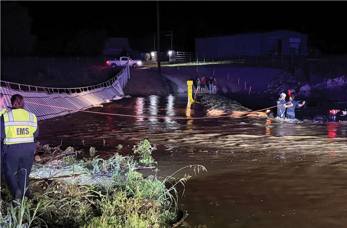
at 9:45 p.m. on a Hamilton Creek crossing on County Road 340, located in an unincorporated area of Burnet County.
Marble Falls Area VFD/ESD No. 6 Fire Chief Derrick Curtis offered details about the incident in which two
firefighters and Burnet County Sheriff's Office personnel worked to bring the drive to safety.
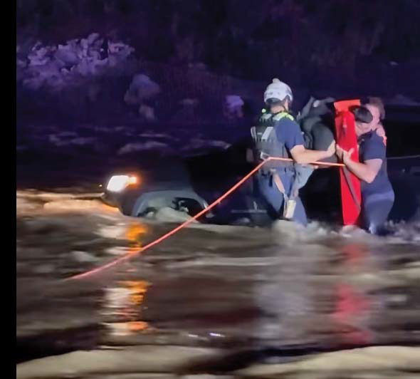
“There was just one individual in the car (a mini-SUV). They made the rescue about 10 or 10:05 p.m.,” he told The Highlander. “It got washed off the roadway about five yards, in about three feet of water.”
When first responders arrived they found the driver, an unidentified man in his mid 20s, inside the vehicle submerged up to the windows.
“The crews set up a safety tether on a fence as an anchor point. Burnet County Sheriff's office minded the rope. Two firefighters (Jared Payne and John Cufr) waded into the water,” Curtis said. “Once they got to the vehicle. They placed the life preserver onto the individual, removed him from the vehicle, created a barrier around him, waded back to land and handed him off to EMS and the Burnet County sheriff's office." The motorist told crews on the scene that he drove around a corner and into the water.
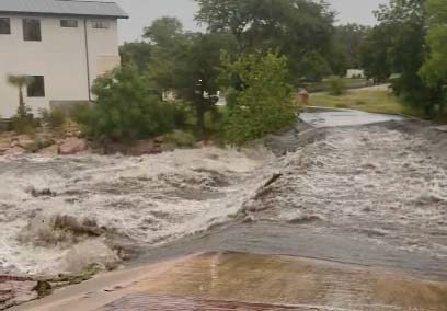
“It wasn’t big rapids. It was a fast moving steady current of water,” Curtis said.
“That’s why it wasn’t moving. If there was another rain surge, it could have pushed more water out.”
Likely, his vehicle may have been stuck in the crossing prior to being swept into the creek.
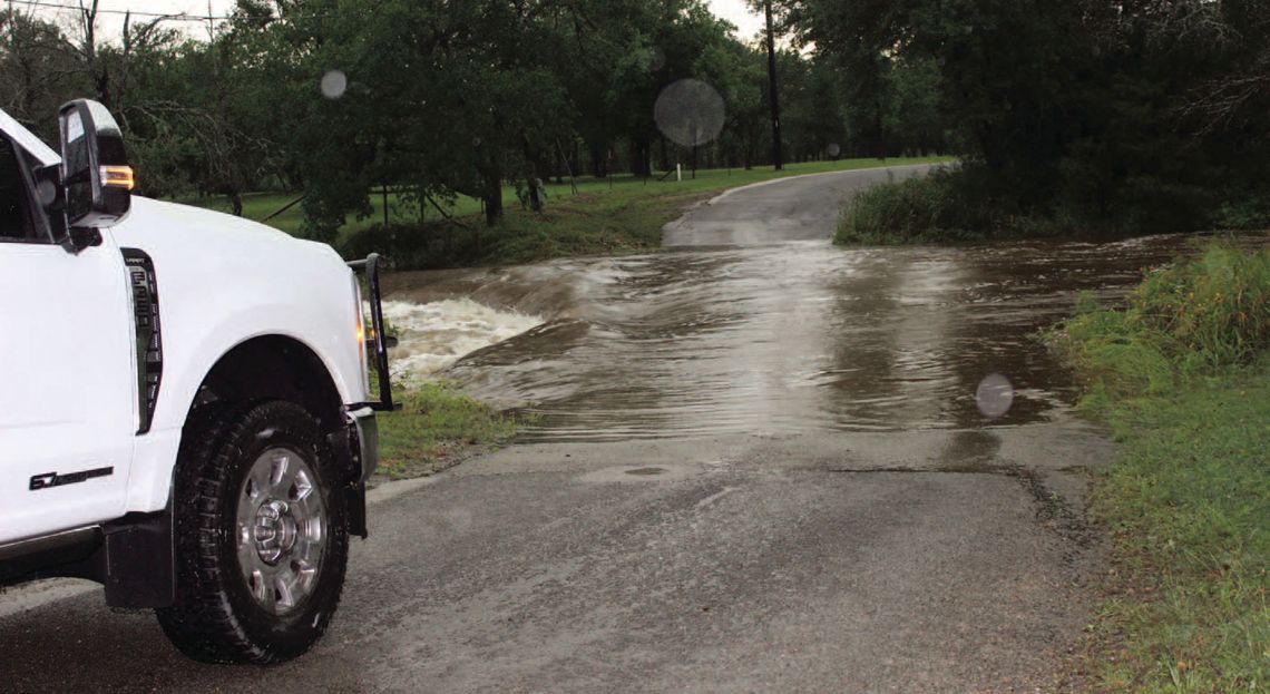
“When water’s over the road, you don’t know if the crossing has been washed out, you don’t know if there’s a hole or debris,” Curtis explained. “Driving across it, you’re creating a hazard inside another hazard.”
Once rescued, the motorist was evaluated by Marble Falls Area EMS and released.
“With the land surrounding areas being so saturated, we will see more flooded low water crossings for the next couple of weeks, even months as long as we keep getting rain,” the fire chief said.
The incident unfolded a few hours after several flash flood warnings were issued around 5:30 p.m. for Burnet, Marble Falls, Kingsland, Gainesville, Granite Shoals, Horseshoe Bay, Meadowlakes, Highland Haven, Longhorn Cavern State Park, Inks Lake State Park, Smithwick, Cottonwood Shores and Sunrise Beach Village.
Llano County flooding was reported with alerts regarding Sandy Creek between Horseshoe Bay and Llano.
Horseshoe Bay officials reported flooded crossings throughout the city, including Hi Circle North, which feeds runoff into Lake LBJ.
According to the National Weather Service May 21: “Doppler radar and automated rain gauges indicated thunderstorms producing heavy rain across the warned area. Between 1 and 3 inches of rain have fallen. Additional rainfall amounts of 1 to 3 inches are possible in the warned area. Flash flooding is already occurring.”
The thunderstorm swept in with moderate to severe rain and lightning as well as flash flooding.
According to Accuweather. com, more rain is predicted for Memorial Day weekend, Saturday and Sunday, May 23-24.
“We’re a couple of months almost to the year of losing the fire chief here due to a swiftwater event,” Curtis shared.
The late MFAVFD Fire Chief Mike Phillips died Independence Day weekend in 2025 as he responded to an emergency call in the middle of the night. His vehicle was swept away at a low water crossing as stormwater runoff pounded the area.
“We’re well aware of the danger. It takes only a couple of inches of water to move your vehicle off a flooded roadway," Curtis said.
“The message we want to share is be vigilant especially if you’re driving on these back roads,” he added. “ It’s a very preventable incident.
“Our education message and prevention is turn around, don’t drown.”