

-
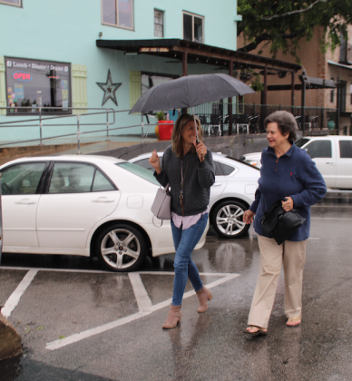 Terry Davis (left) and Julie Barho were among visitors to Marble Falls on Thursday, June 3 who braved wet weather. Connie Swinney/The Highlander
EDITOR'S UPDATE: The Lower Colorado River Authority partially opened a floodgate on Thursday, June 3 to handle excess runoff into Lake Marble Falls. Other issues stemming from the thunderstorms and rain for the past several days included an uprooted tree and downed branches in Burnet County, citywide low-water crossing closures in Horseshoe Bay, lightning strikes causing temporary power outages and at least one report of structure damage in the Tobyville area.
--
Rain and scattered thunderstorms spread across the region (the week of June 1) as another wave of low pressure tracked across the region out of northern Mexico and northwest Texas.
This is part of the same unsettled pattern that has been in place since early last week.
A wet and unsettled weather pattern is forecast throughout the week and the upcoming weekend. Tuesday’s weather maps showed a large trough of low pressure in the middle and upper atmosphere stretching from the Great Lakes to northwest Texas.
This trough is forecast to remain essentially stationary through late week and will allow a series of small waves of low pressure to move over the area.
Each wave will have the potential to cause the development of widespread showers and thunderstorms between Wednesday and Friday. The probability for rain each day will be near 70-80 percent.
Despite having high-resolution forecast data, trying to time the passage of these waves of low pressure is not very clear.
Rainfall forecasts call for daily totals to average between 0.5 and 1 inch, with isolated heavier totals. With the ground currently quite wet and in some cases saturated from recent rains, these additional rains will cause efficient runoff and could lead to flash flooding.
The threat for severe storms through Friday is forecast to be low.
High temperatures Wednesday through Friday are forecast to generally be in the low and mid-80s.
The outlook for the upcoming weekend (Saturday and Sunday, June 5 and 6) calls for more periods of rain and storms across the region as a piece of the upper trough situated over the state breaks off and very slowly meanders to the east.
With the atmosphere quite moist and unstable, the probability for rain will remain near 70-80 percent. Rain amounts each day are forecast to average between 0.5 and 1 inch, with isolated heavier totals. High temperatures are forecast to be mostly in the mid-80s.
Forecast solutions are indicating it will be a very wet period over the next five days. Forecasts for the period between Tuesday evening and Sunday evening call for widespread totals of 3-5 inches for the eastern Hill Country, all of Central Texas and the middle Texas coast. Slightly lower totals are forecast across the western and northern Hill Country.